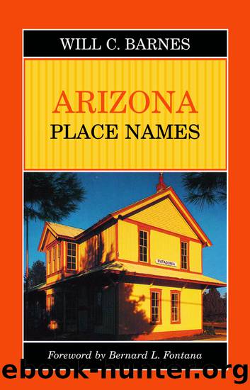
Arizona Place Names by Will Croft Barnes & Bernard L. Fontana

Author:Will Croft Barnes & Bernard L. Fontana [Will C. Barnes & Bernard L. Fontana]
Language: eng
Format: epub
Publisher: University of Arizona Press
Published: 2015-03-30T00:00:00+00:00
GREAT SALES OF LOTS AT PHOENIX, ARIZONA on the 23rd and 24th of December."
First lot sold was on corner of Washington and Montezuma streets, to Judge Berry of Prescott for $104. City was incorporated by the Legislature, 1880.
Vanished Arizona says, "December, 1878, we took supper in Phoenix at a place known as Devine's. Even then its gardens, orchards and climate were becoming famous."
Phoenix Mountains Maricopa Co. U. S. G. S. Map, 1923.
Small group of hills of which Camelback is southern point. West side Paradise valley. After the city.
Phoenix Mountain Park Maricopa Co.
Tract of some 15,880 acres of mountain land five miles south of Phoenix at end of South Central avenue. Embraces most of Salt River mountains. Purchased by city from Federal government. Tract covers nearly every form of cacti, trees, and shrubs peculiar to Southern Arizona. Doctor Turney was anxious to have this park called "Komatke" Pima word meaning a "blue hazy mountain." His idea did not get over, however. See Salt River mountains.
Phoenix Park Navajo Co. U. S. G. S. Map, 1923.
In T. 11 N., R. 17 E. Ranch and watering place at head Phoenix Park wash near Apache Ind. Res. So named by James Stinson, 1882, who ran cattle here for some years. He had a farm near Phoenix and called this park for that place. Known now as the Holcomb or Hokum ranch, q.v.
Phoenix Park Canyon Navajo Co. Map, Fort Apache Ind. Res., 1928.
Fort Apache Ind. Res. Stream rising at boundary line, Fort Apache Indian Reservation near north end of T. 10 N., R. 17 E., above Phoenix Park ranch. Flows south into Carrizo creek on reservation. After park by this name to the north in Sitgreaves N. F.
Phoenix Park Wash Navajo Co. Map, Sitgreaves N. F., 1924.
In T. 10 N., R. 17 E. Dry wash heading near line Fort Apache Ind. Res. Runs northeast into Big Dry lake in T. 14 N., R. 19 E. So named by James Stinson, who first owned Snowflake valley and ran cattle all over this region as early as 1873. See Phoenix Park.
Pica Yavapai Co. G. L. O. Map, 1921; U. S. G. S, 1923.
Station A. T. & S. F. R. R. 23 miles west Seligman. Originally called Picacho after nearby mountain.
"There was a station by this name, Picacho, on Southern Pacific, which made confusion in shipments. Officers of Santa Fe and Southern Pacific matched coins to see which road would changeâSanta Fe lost. Hence Pica." A.G.W.
Picacho Pinal Co. Smith Map, 1879; G. L. O. Map, 1921.
Sp, "peak or point." Station S. P. R. R. opened about 1881, 46 miles northwest of Tucson. Well-known stage station in early days. Located in Picacho Pass, q.v. P. O. established June 26, 1881, Manuel S. Ramirez, P. M.
Poston marching from Yuma east writes poetically, "We camped at night at old Picache, a peak for which you'll find no match."
Picacho Coconino Co. Map, U. S. G. S., 1923.
Sp, "peak." Peak in northwest corner T. 21 N, R. 4 W. south of Crookton station A. T.
Download
This site does not store any files on its server. We only index and link to content provided by other sites. Please contact the content providers to delete copyright contents if any and email us, we'll remove relevant links or contents immediately.
Giovanni's Room by James Baldwin(7301)
The Plant Paradox by Dr. Steven R. Gundry M.D(2596)
The Stranger in the Woods by Michael Finkel(2508)
Miami by Joan Didion(2354)
Wild: From Lost to Found on the Pacific Crest Trail by Cheryl Strayed(2243)
INTO THE WILD by Jon Krakauer(2187)
Trail Magic by Trevelyan Quest Edwards & Hazel Edwards(2166)
DK Eyewitness Top 10 Travel Guides Orlando by DK(2163)
Vacationland by John Hodgman(2119)
The Twilight Saga Collection by Stephenie Meyer(2115)
Nomadland by Jessica Bruder(2050)
Birds of the Pacific Northwest by Shewey John; Blount Tim;(1956)
The Last Flight by Julie Clark(1938)
Portland: Including the Coast, Mounts Hood and St. Helens, and the Santiam River by Paul Gerald(1908)
On Trails by Robert Moor(1887)
Deep South by Paul Theroux(1819)
Blue Highways by William Least Heat-Moon(1756)
Trees and Shrubs of the Pacific Northwest by Mark Turner(1706)
1,000 Places to See in the United States and Canada Before You Die (1,000 Places to See in the United States & Canada Before You) by Patricia Schultz(1634)
